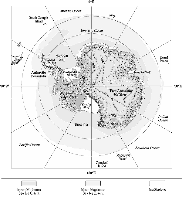
Figure 16-2: Location map
for the Antarctic. Elevations on Antarctic continent are indicated by dashed contour
lines (500-m interval). Topography and ice shelf outlines are from U.S. Geological
Survey and British Antarctic Survey data. Sea-ice extent data are from Couper
(1989).